
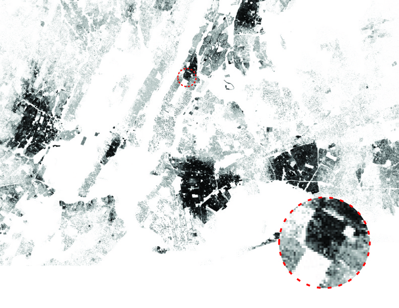
Project1_Final_The NY Metropolis fragmented by Robert Moses' Brooklyn-Queens Expressway built between the 1950s and 1960s. Note how the highway separates the rest of Queens from its northernmost neighborhood of Ditmars, isolating it.
 The isolation of this neighborhood is reflected in its demographics. In 1974, Turkey invaded Cyprus, causing a mass migration of people to flee from Greece to New York, settling mainly in Ditmars. Whereas the rest of Astoria has diversified with Blacks, Latinos, Asians, and Caucasians, the Brooklyn-Queens-Expressway caused a spatial and metaphoric divide, isolating Ditmars and its primarily ethnic Greek/Caucasian residents.
Jacinda.Ross_Assignment1_Final
Leave a comment


![manhattan 125th residentials [Converted]](https://theoryofurbanform2013.files.wordpress.com/2013/12/manhattan-125th-residentials-converted.jpg)
![manhattan 125th retail [Converted]](https://theoryofurbanform2013.files.wordpress.com/2013/12/manhattan-125th-retail-converted.jpg)


